Terrain
Overview of Functions
Ability to create terrain solid models using DWG / DXF topographic maps and boring data.
Details of Functions
Create Tab
Classification
Geometry
Terrain Table > Ground Surface
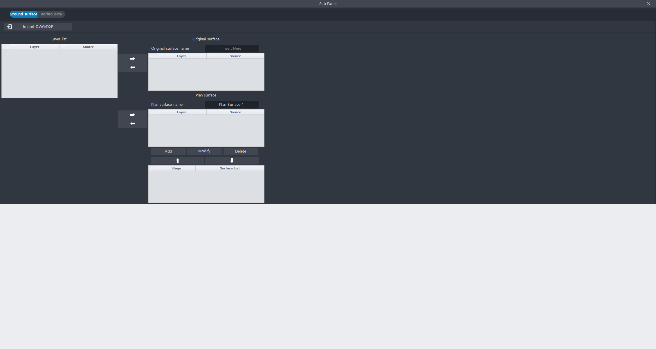
This function is to manage the surface of the ground and the surface of the planned ground.
Create a surface by importing a DWG / DXF file.
One base can be created and several planned can be created.
Import DWG/DXF : Clicking the button brings up the Explorer, and you can import DWG / DXF files.
Layer list : The layer list of the imported DWG / DXF file is displayed.
- Layer column: The name of the layer is displayed.
- Source column: DWG / DXF name is displayed.Original Surface : Some of the layers can be defined as original surfaces.
- Layer column: The name of the layer is displayed.
- Source column: DWG / DXF name is displayed.Plan Surface : Some of the layers can be defined as Plan Surface.
- Layer column: The name of the layer is displayed.
- Source column: DWG / DXF name is displayed.
- Stage: Indicates the order of the planned ground. The order of the planning grounds is determined by the stage order.
- Surface List: The name of the plan ground appears.
Terrain Table > Boring data
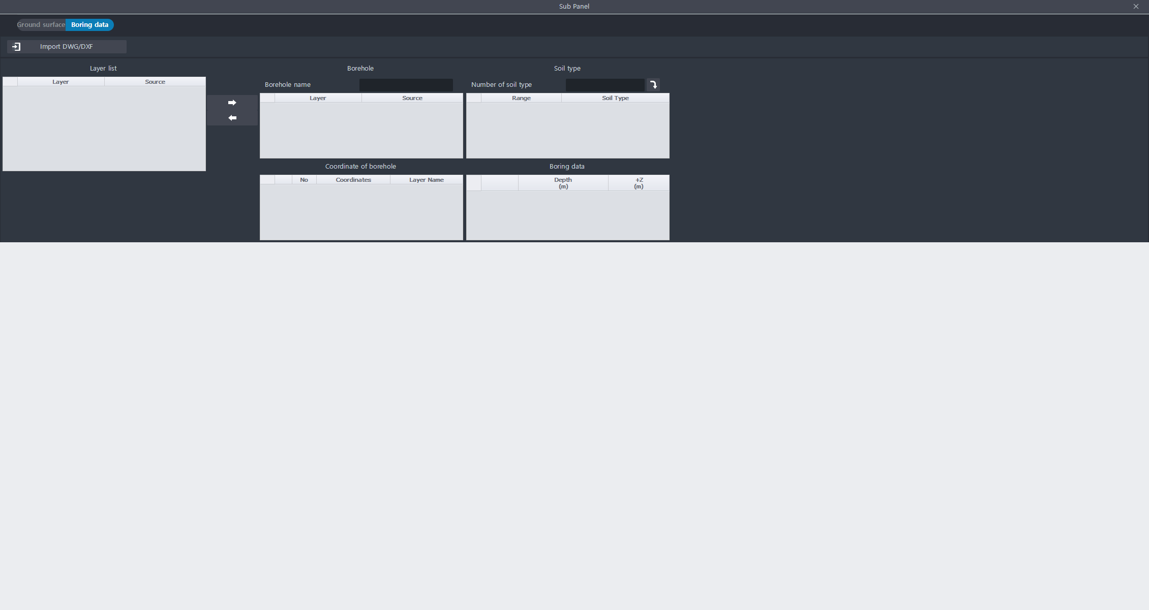
This function is to manage boring data.
When you enter a layer with 1D circle data or point data into the Borehole table, the borehole coordinates are automatically registered in the Borehole Coordinates table.
Set the type of soil according to the depth, and enter the type of soil according to the depth of each borehole.
Layer list : The layer list of the imported DWG / DXF file is displayed.
- Layer column: The name of the layer is displayed.
- Source column: DWG / DXF name is displayed.Borehole : You can import a layer with drilling data.
- Layer column: The name of the layer is displayed.
- Source column: DWG / DXF name is displayed.Coordinate of borehole : Automatically finds the coordinates of boreholes based on the information entered in the Borehole table. Coordinates are extracted from 1D Circle or 1D Point information existing in the layer.
- No column: Number of boreholes is displayed.
- Coordinates: The surface position coordinates of the borehole appear in the form (x, y, z).
- Layer Name: The name of the layer is displayed.Soil type : Defines the type of soil according to the depth.
- Number of soil type: Enter the total number of soil types that make up the terrain.
- Range column: Sets the depth section. You can set from Z0 to Zn.
- Soil Type column: You can enter the type of soil.Boring data : : If you select one borehole in the Coordinate of borehole table, you can enter the borehole for that borehole.
- Depth: Depth means only a positive number.
- + Z: Enter the value minus the depth value from the Z coordinate of the actual borehole.


